Post-Frost Event Summary- May 30, 2023
Good morning,
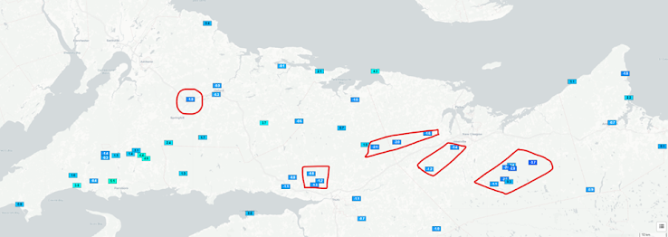
It looks like a safe morning for most of the fields in the province with concerns on some fields in Pictou (3 weather stations and nearby fields to watch). I am not as worried as last week’s frost but there are a few fields near those areas worthwhile to be checked.
If you have any feedback or things to share, please text or call Hugh Lyu, at 902-890-0472; or hlyu@perennia.ca. Thank you!
I would suggest growers
who have fields near those areas/weather stations check their fields and assess
potential frost damage, especially fields in Pictou.
|
Counties and
Weather Stations |
Lowest
Temperature Observed (Celsius) |
Duration (hrs) of
temperatures below -2 C |
|
Colchester |
||
|
Belmont (NSW087 and
NSW037) |
-1.3 |
0 |
|
Upper Kemptown
(NSW022) |
-2.1 |
0 |
|
|
|
|
|
Cumberland |
||
|
North Harrison Settlement (NSW065)
|
-1.4 |
0 |
|
Salt Springs (NSW077)
|
-1.8 |
0 |
|
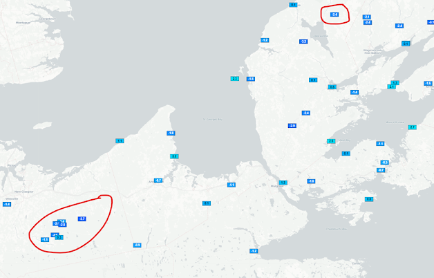
Pictou |
||
|
Dalhousie
(NSW074) |
-2 |
2 |
|
Four Mile Brook
(NSW021) |
-1.6 |
0 |
|
Hazel Glen (NSW086) |
-1.4 |
0 |
|
New Gairloch (NSW019) |
-1.2 |
0 |
|
Sunny Brae
(NSW058) |
-2.6 |
1 |
|
Blanchard Road (NSW059) |
-2.6 |
6 |
|
Blue Mountain (NSW060) |
-2.8 |
6 |
|
Moose River (NSW061) |
-3.7 |
7 |
|
Fields near Blanchard Road, Blue Mt. and Moose River are around 10% bloom which puts those fields at a lower risk but damage would still occur to any open flowers. |
|
|
|
Antigonish |
||
|
|
|
|
|
South Shore Counties |
||
|
|
|
|
|
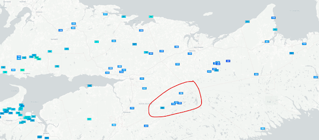
Cape Breton |
||
|
Keppoch
(NSW029)
|
-2.4 |
1 |
|
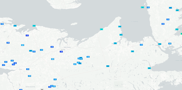
Hants and Halifax Regional Municipality (HRM) |
||
|
Chaplin
(NSW071)
|
-2.6 |
1 |
|
Dean (NSW069)
|
-1.5 |
0 |
|
Woodside
(NSW070) |
-1.2 |
0 |
Please click the below images to see a bigger and clear picture of minimal temperatures from weather stations: